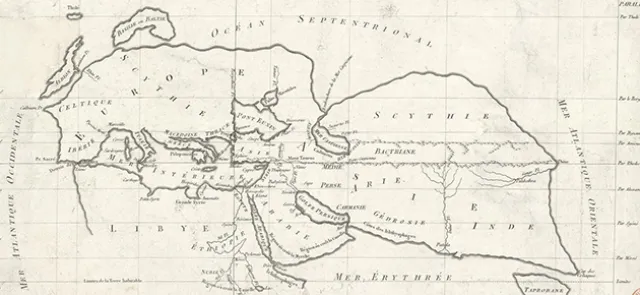





In August 2025, the African Union officially endorsed the "Correct the Map" campaign led by Speak Up Africa and Africa No Filter. Its aim? To end the widespread dissemination of the Mercator projection and promote other ways of mapping our planet. It is no coincidence that African countries have taken up the issue: in the Mercator projection, territories near the poles appear much larger than they really are. Selma Malika Haddadi of Algeria, Deputy Chairperson of the African Union Commission, stresses that this is more than a simple change of map, since projections that make Africa appear relatively small instil a sense that the continent is marginal. Moky Makura of Nigeria, Executive Director of Africa No Filter, goes further, declaring that the circulation of the Mercator map has amounted over the centuries to "the world's longest-running disinformation and misinformation campaign [and that it] simply has to stop." After all, these maps are used not only in the media but also in schools. As a result, many schoolchildren, students and even adults unconsciously absorb these relative sizes, potentially distorting their understanding of the world. To see for yourself, try answering a few of the questions in the box.
A question of geometry
Let us go back a few centuries and consider the problem from a purely geometric perspective. The aim is to represent on a map—that is, on a flat sheet—the arrangement of the continents as they lie on Earth, which for simplicity we shall treat as a perfect sphere. This is no easy task, as anyone with a sweet tooth can readily see. Look at the spherical hazelnut confections served at the ambassador's receptions: their gold foil wrappers are incredibly crumpled. And with good reason! The theorema egregium (Latin for "remarkable theorem"), proved by Carl Friedrich Gauss in 1827, implies that a sheet of paper cannot be folded into a sphere because, to put it more technically, the two objects have different curvatures and are therefore not locally isometric. It is thus impossible to map the Earth's surface without distortion: both lengths and the shapes of objects (as determined by their angles) cannot be preserved at once.
This geometric result does not mean all is lost. When only a small part of the Earth's surface needs to be mapped, a wealth of solutions can produce perfectly satisfactory maps. And when we want to represent the whole world, we are not doomed to carry a cumbersome globe around: we simply need to make informed choices and weigh their advantages and disadvantages.