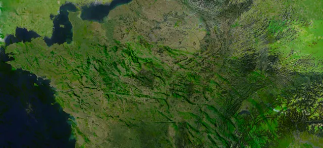




The most conventional approach defines this locus as the centroid of the region occupied by France—in other words, of a physical "plate" with that shape. But this is where differences begin to emerge… Do we include:
• Corsica?
• all the coastal islands, such as Noirmoutier (Vendée) and many others?
• the overseas departments, including, for example, Martinique, Guadeloupe, Mayotte and French Guiana?
• or even the overseas collectivities, including, for example, French Polynesia and Wallis and Futuna? And what about the French Southern and Antarctic Lands?
The usual approach is to consider metropolitan France, including Corsica and the coastal islands. But when were the calculations carried out? Do they account for the curvature of the Earth, in which case the center of mass lies beneath the Earth's surface and the "closest" point on the surface is used instead? This is no trivial question: recent calculations by the Institut géographique national take this factor into account!
One could also take topography into account—essentially, the mass of the mountains. The same question can arise for lakes… Neither factor is included in current calculations.
That said, "the" center of France could also be calculated as the weighted centroid of a finite number of points: the centers of France's roughly 35,000 municipalities, each weighted according to the municipality's area.
Other definitions could be used, such as the center of the largest inscribed disk (see page 14) or the center of the smallest disk containing all of France. It is hardly surprising, then, that ever since the concept arose, numerous municipalities have vied for the title of "center of France"!
All eyes on the Cher
------------------------------------------
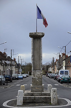
The first municipality to claim the title of "center of France" lies in the Cher: Bruère-Allichamps (46° 45′ 47″ N, 2° 25′ 29″ E). The calculations by geographer Adolphe-Laurent Joanne (1813–1881), who initiated the quest, did not include Corsica. A Roman milestone dating from the 3rd century, found nearby, marks this center.
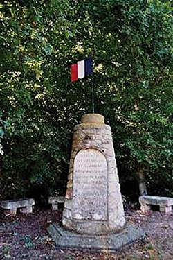
The village of Saulzais-le-Potier (46° 36′ 21″ N, 2° 29′ 54″ E), in the Cher, also claims the title, based on the location of a monument erected in 1947 following calculations by Abbé Théophile Moreux (1867–1954), described on its inscription as a "mathematician and astronomer."
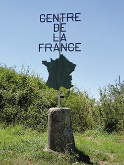
Farges-Allichamps (46° 45′ 34″ N, 2° 24′ 04″ E), also in the Cher and near Bruère-Allichamps, is home to the "Centre de la France" rest area on the A71 motorway. Many other villages in the Cher and the Allier also claim the title.
The current winners?
----------------------
According to a recent calculation by the Institut géographique national, Nassigny (46° 29' 38" N, 2° 36' 10" E), a municipality of nearly two hundred inhabitants in the Allier, is considered the center of metropolitan France, including Corsica and the coastal islands. The method is well established for this type of calculation and does not take topography into account.
The village of Chazemais (46° 29' 01" N, 2° 31' 35" E), also in the Allier and six kilometers from Nassigny as the crow flies, marks the weighted centroid of the centers of all the municipalities in metropolitan France, with each municipality weighted by its area.
To discover the center of the largest inscribed disk… simply turn the page! As for the center of the smallest disk containing all of mainland France, it lies in the municipality of Tranzault (46° 36' 22" N, 1° 52' 31" E), in the Indre, sixty kilometers west of Nassigny.