



This prompted the development of precision timekeeping (and the sextant) from the 17th century onward, since an error of one minute shifts your position by one nautical mile (1,852 m) in longitude. Today, GPS is the standard positioning tool. It provides accuracy on the order of a metre. That is sufficient for many purposes, but not for guiding an aircraft or a car!
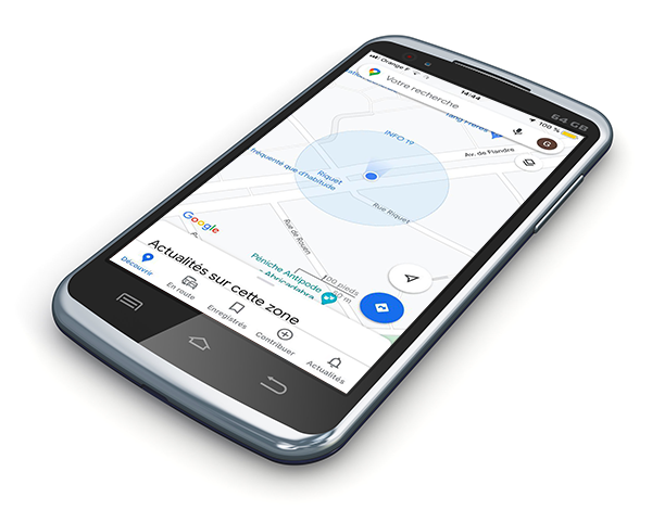
It is essential to know not only your position but also its uncertainty (or error). The calculation is difficult (and approximate), as it involves several factors that are hard to control. In practice, an approximation is used in which the error is modelled by a Gaussian distribution; the probability that the unknown "true" position lies within a circle centred on the estimated position increases with the circle's radius. This circle represents the circular error probable (CEP). The circle shown around the blue dot on your GPS typically corresponds to a probability of 68%.